[EN] | [ES]
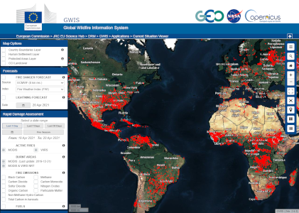
This application provides near-real time information on:
1) Fire danger forecast up to 10 days in advance on the bases of the Canadian Fire Weather Index (FWI)
2) Lightning occurrence
3) Active fire detections from the NASA MODIS and VIIRS sensors
4) Near-real time burnt area perimeters derived from MODIS and VIIRS
5) Fire emissions from the Copernicus CAM Service
In addition, access to a static global fuel map is available.

Statistics are provided at national level and for regions of interest, such as the “Brazilian Legal Amazon” and the Arctic Monitoring and Assessment Program (AMAP).
The portal provides information on the evolution of the current fire season through the provision of:
1) Current statistics of burnt areas and number of fires, as compared to the average of the last 10 years. Statistics of the current year can be compared to a single year or a period in the past.
2) Seasonal cumulative trend in burnt areas and number of fires as compared to the average of the last 10 years.
3) Number of thermal anomalies detected by the VIIRS sensor as compared to the average of thermal anomalies for the last 10 years.
4) Number of thermal anomalies detected by the MODIS sensor as compared to the average of the thermal anomalies for the last 10 years.

This application provides a historical overview of fire regimes at country and sub-country level for the period 2002-2019. It includes maps of yearly/monthly burnt areas, burnt area frequency and burnt area seasonality. Additionally, it provides multi-year and single-year charts of
1) Number of fires derived from GlobFire
2) Burnt areas derived from MODIS MCD64A1
3) Fire regimes (seasonality)
4) Monthly fire size distribution per year
5) Landcover damage and
6) Yearly/monthly wildfire emissions
Data are downloadable in the application.

Monthly and seasonal forecast of temperature and rainfall anomalies that are expected to prevail over the world.

This application provides access to the data used in the GWIS applications. Data from the Current Situation Viewer are provided in the form of Web Map Services (WMS).